GeoSection Land Desktop English 4.0
- Categoría: Graphic Editors
- Licencia: Shareware
- Tamaño: 10.04 KB
- Sistema: w2000 wXP
- Idiomas:

A graphic tool to do readings, topographs, draw curves, vertices, notations, etc.
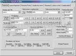
If you have already tried Autodesk Land Deskpop (an excellent graphic tool to edit terrain and road mapping), then you will be interested in this plug-in called GeoSection Land Desktop, which offers new features to topographic readings.
Some of the new features that GeoSection Land Desktop adds are: it lets you do field topographic readings and adjust them; it comes equipped with tools to draw level curves on the terrain, generate polygonal construction boxes and insert curves, longitudinal vertice profiles and transversal sections; you can find volume calculations, run co-ordinate conversion tools, etc.
As if that wasn`t enough, GeoSection Land Desktop lets you minutely document each project with descriptive memos, notes and observations. From other modules you can establish hierarchies of all the processes that are being done, create transversal sections and even predict possible terrain movements.
DownloadGeoSection Land Desktop English 4.0 related downloads


ACDSee Photo Manager 18
 Download
International versions of this excellent image administrator and viewer, with many supplementary functions.